There are a couple of free mapping services under development and available for use, which, if you haven’t heard about them, you should take a look at.
Now these aren’t your typical maps. This is a new style of doing things, and the maps are of the whole world. So, if you want to improve your geography, this is the way to do it. Going on holiday this summer? Do you know exactly where in the world it is? What’s near it?
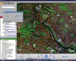
Google and Microsoft are the pioneers. Google are developing a downloadable software package called “Google Earth“, and an online source called “Google Maps“. You can use both right now. Google Earth requires a fairly fast computer and a broadband connection, and doesn’t support Apple or Linux computers yet. Microsoft are developing “MSN Virtual Earth“, which works from within a web browser. Both use traditional mapping views plus aerial photographs, taken from a mix of satellites and aeroplanes. Microsoft, for example, have hired their own mini-fleet to upgrade the aerial images of the USA.
To be honest, I’ve had a look at MSN Virtual Earth, but I didn’t really get sucked into it. It feels awkward and counter-intuitive to use, and I can’t find what I want quickly. Google Earth, on the other hand, is something else. You do need a fair bit of power to run it (any PC less than 2 years old should be OK), but spinning the globe around, and zooming from location to location around the world is superb. The built-in search engine is excellent (as you’d expect), and you can keep a history of recent places visited. Once you’re looking at a location, you can then search for places within that location: restaurants, tourist info offices, parks, places to stay, banks, coffee houses, pharmacies – you name it, it’s probably there.
The image can be terrain mapped, meaning you can change the angle at which you view the map from top down to somewhere lower, and see the shapes of hills, valleys and mountains. You can see roads and borders on the map if you wish, and in recently updated areas (for example, Manhattan, NY) you can even see buildings as 3D structures and get a shape of the place. Stunning.
I’m going on holiday to Nerja, Spain in a few weeks. I know where it is already, but I want to know more. In Google Earth’s search bar, I choose the “fly to” tab, enter “Nerja, Spain”, and hit search. It finds the town instantly, and offers to fly me there. The Earth spins, and slowly zooms in on Europe, and then Spain, filling in city names and increasing the resolution of the aerial map as we get closer. I can see the shape of the coast, the inlet to the Mediterranean Sea, even the relief of the seabed itself. I can see the mountains, and recognise the snowy peaks. By changing my angle of view to look from the sea into Nerja I can recognise the peaks and find out their names: Laguna del Caballo, Laguna la Mosca. Top.
I can slide back to the coast by dragging the mouse, and zoom back in on the town by pressing the “+” key or double-clicking on the town’s name. There’s a link to search Google and to get directions to or from here. I’ll use that later for the airport. The satellite images here are pretty crap, so I’ll overlay the roads so I can get my bearings. The roads fade in, with names. Right I’ll have a mooch around.
Honestly, this is a superb piece of work, and it’s going to get better and better. You can interact with the maps, placing markers for points of interest with weblinks to websites and webcams. Many already have. You can measure routes (I use it to accurately measure running routes). You can hook it up to a GPS receiver (Google Earth Plus: $20 version) and download routes you’ve travelled.
Currently this is a Beta version of the software, at Beta Version 3.0, but you wouldn’t know it. Try it out today. The aerial mapping of Swansea and the Gower is pretty good. I should add the University and its webcam as a point of interest.